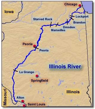
The Illinois River is 273 miles long from its origin where the Des Plaines and Kankakee flow together to its mouth north of Alton, where it flows into the Mississippi (Illinois Department of Natural Resources).
The Report of the Rivers and Lakes Commission on the Illinois River, published in 1915, includes the following description:
"In many respects the Illinois River is one of the most remarkable streams in the United States. Its past importance as an avenue of water commerce, the possibilities of its future in this respect, its fresh water fisheries, its use as the main sewer, so to speak, of the second city in the country, and more recently, the agricultural development on its bottom lands through the construction of levees, all have led to perhaps more thorough studies, with various objects in view than has been received by any other of our rivers."
The introduction to the Integrated Management Plan noted that as of 1995 90% of the state's population lived in the 55 counties that comprise the Illinois River watershed. Two of Illinois' three UNESCO Ramsar Wetlands of International Importance, The Emiquon Complex and the Sue and Wes Dixon Waterfowl Refuge at Hennepin & Hopper Lakes, are adjacent to the Illinois River.
The reports and other documents on the Illinois River included here address a wide range of issues including settlement, navigation, game wildlife and other biota, water quality, sedimentation, flooding, and land use. Documents focusing on management of the Illinois River and data resources are listed in the right-hand column.
 The Plankton of the Illinois River, 1894-1899, with introductory notes upon the hydrography of the Illinois River and its Basin. PART I. Quantitative Investigations and General Results by
  The Plankton of the Illinois River, 1894-1899, with Introductory Notes Upon the Hydrography of the Illinois River and its Basin. Part II. Constituent Organisms and their Seasonal Distribution by
  Studies on the Biology of the Illinois River by
  Some Recent Changes in Illinois River Biology by
 Temperature and Turbidity of Some River Waters in Illinois
 The Illinois River by
  Illinois River Bluffs Area Assessment
 Big Rivers Area Assessment
 Prairie Parklands Area Assessment
 Illinois River Bluffs Area Assessment
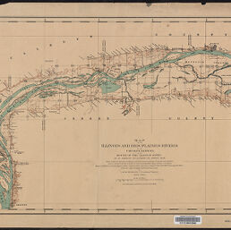
in 14 sheets including an index map. Made under the direction of a Board of Engineers ... Corps of Engineers, United States Army, by J. W. Woermann, 1902-1905.
From the collection "River Maps" created by the Map Library in the University Library's Digital Collections portal
from Danglade (1914) The Mussel Resources of the Illinois River
from Forbes & Richardson (1913) Studies on the Biology of the Upper Illinois River, INHS Bulletin Vol.9 Article 10, 1913
from Forbes & Richardson (1913) Studies on the Biology of the Upper Illinois River, INHS Bulletin Vol.9 Article 10, 1913
from Forbes & Richardson (1913) Studies on the Biology of the Upper Illinois River, INHS Bulletin Vol.9 Article 10, 1913
from Richardson (1925) Changes in the Small Bottom Fauna of Peoria Lake 1920-1922, INHS Bulletin Volume 15 Article 5
from Richardson (1925) Changes in the Small Bottom Fauna of Peoria Lake 1920-1922, INHS Bulletin Volume 15 Article 5

From 1937-1947 Illinois Historical Aerial Photographs in the Illinois Geospatial Data Clearinghouse

From 1937-1947 Illinois Historical Aerial Photographs in the Illinois Geospatial Data Clearinghouse

from the iFish Illinois page describing the Illinois River